
On April 22, 2025, a fire began in a wildlife management area near the town of Waretown in New Jersey. Within two days, the blaze had spread into one of the largest fires the state has seen in decades. Images captured by NASA's Landsat 9 satellite have help reveal the scope of the devastation left behind.
What is it?
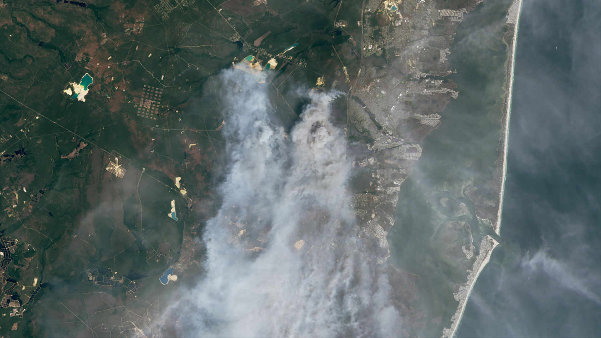
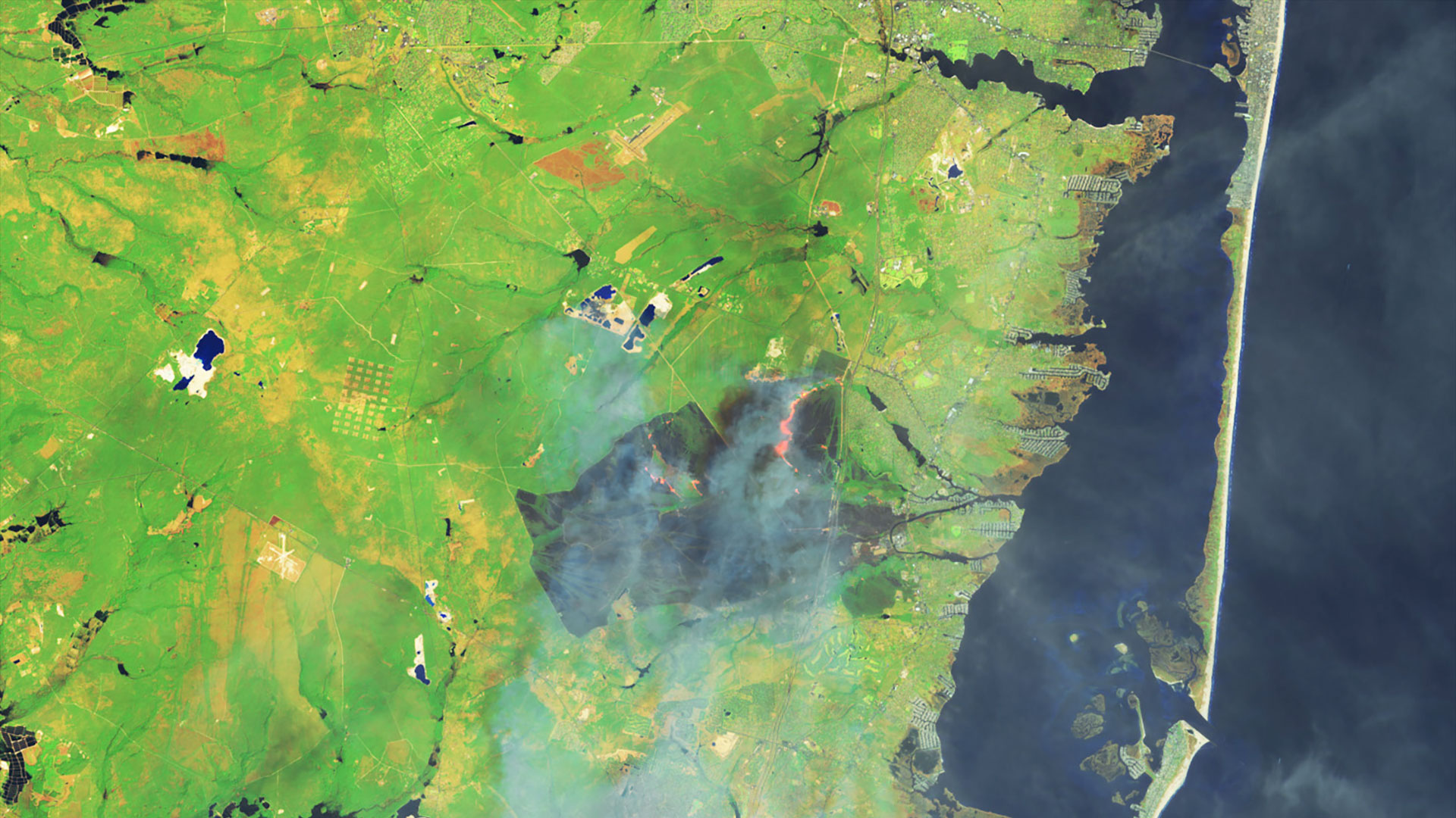
The Operational Land Imager-2 (OLI-2) instrument on the Landsat 9 satellite sent back these images of the Jones Road fire on April 23, 2025. In this natural-color scene, thick smoke obscures the fire’s mark on the land below.
The burned area is revealed when viewed in shortwave infrared, near infrared and visible light. In the false-color image of the same area, unburned vegetated areas (green) and the recently burned landscape (brown) are more easily identified.
Where is it?
The Pine Barrens, also known as the Pinelands, is located in southeastern New Jersey. It's a sprawling ecosystem covering about 1.1 million to 1.4 million acres (445,000 to 567,000 hectares).
The fire has led to evacuations of people from Lacey and Ocean townships and sent smoke wafting toward New York City. Conditions have resulted in the closure of the Garden State Parkway at times.
Why is it amazing?
NASA is generally associated with looking outward into space, but by pointing its satellites back at our planet, the agency has been able to help reveal warning signs for large wildfires like this one in New Jersey.
Earlier observations from NASA's GRACE (Gravity Recovery and Climate Experiment) and GRACE-FO (GRACE Follow On) satellites showed anomalously dry conditions in the area, pointing to the Pine Barrens being particularly susceptible to a fire in the spring of 2025.
At the time of the fire, the U.S. Drought Monitor had classified drought in the region as "severe."
Want to know more?
You can read more about Landsat 9, NASA's most powerful Landsat satellite ever, and see more of its imagery. You can also read more about the role of satellites monitoring wildfires.


 English (US) ·